
GEORGIA / LAND PHOTOGRAPHY & VIDEO
Bring the land
into focus.
Aerial photography and films that help buyers understand the parcel, its setting, and its possibilities.
FOR LAND BROKERS, PROPERTY OWNERS & DEVELOPERS
Give the listing
a sense of place.
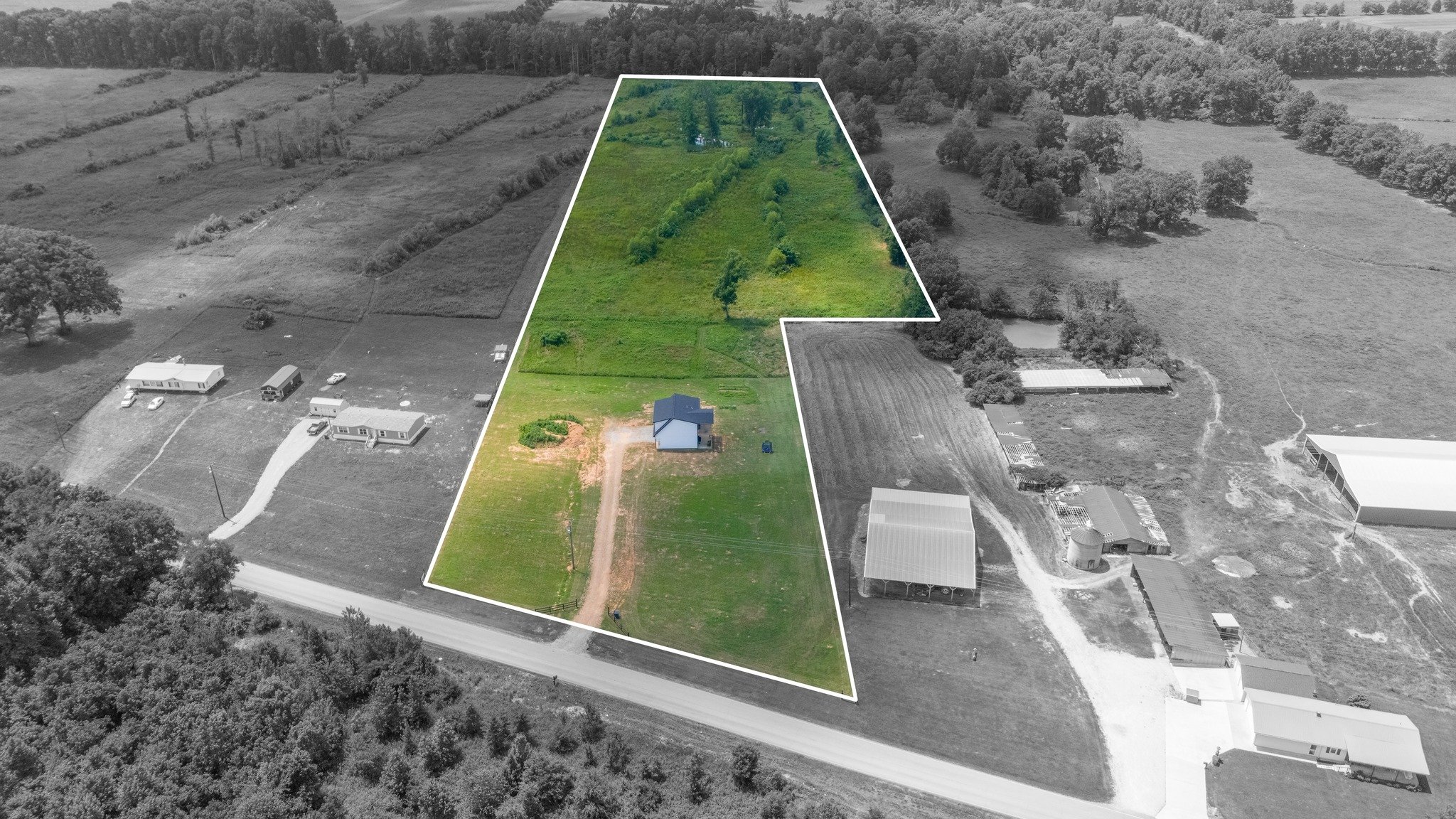
Land can be difficult to explain from the roadside. A wider view brings the subject parcel, visible approaches, terrain, and surroundings into one clear presentation. We create photography and video for listing campaigns, broker presentations, and land evaluation across Georgia.
THE RIGHT CAPTURE / THE RIGHT PURPOSE
Built around your brief.
Agree the scope, outputs, and delivery
before capture begins.
- 01
Aerial photography
Show the property from a range of perspectives, from a broad view of its surroundings to closer views of important visible features.
- 02
Land marketing films
Guide the viewer through the setting and the subject property with an edited film built around your marketing objectives.
- 03
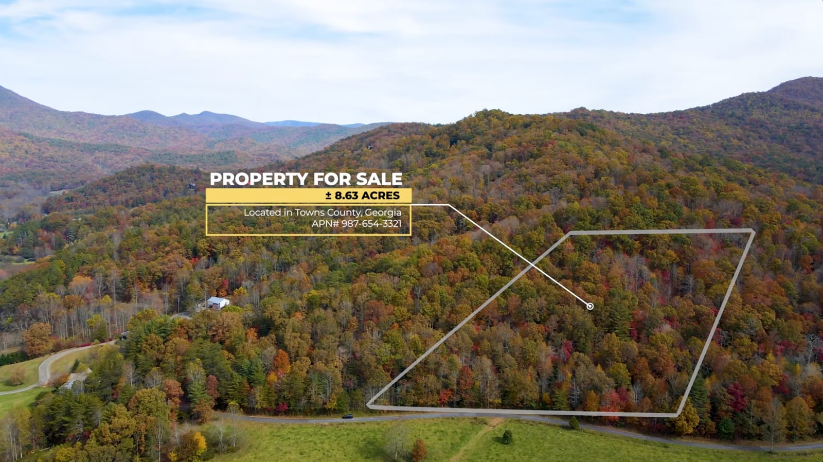
Parcel boundary overlays
Use supplied boundary information to illustrate the subject parcel in selected photographs or film sequences. Agree on the reference information and graphic treatment before production.
SKY360 / IN MOTION
Land marketing in motion
See how aerial storytelling and parcel overlays work together in a Sky360 land film.
Watch on YouTube ↗A CLEARER UNDERSTANDING
Imagery that supports
land evaluation.
Aerial imagery can also support a buyer’s or project team’s due-diligence process by documenting visible conditions and bringing questions into focus. It provides context for access, vegetation, terrain, and neighboring uses; legal access, boundaries, development suitability, and other conclusions require their own appropriate verification.
START WITH THE PURPOSE
A useful first conversation.
Share what you know. We’ll help identify the right imaging approach.
- 01Property location and the parcel or parcels to feature
- 02Your audience, intended use, and important visible features
- 03Available boundary references and any questions about them
- 04Preferred photographs, film, and timing
BEFORE WE BEGIN
A few useful answers.
Can you add property lines to the imagery?
+
We can discuss parcel overlays using supplied reference information. The source, intended use, and presentation need to be agreed as part of the project. Marketing outlines provide visual context; they do not establish legal boundaries or replace a boundary survey.
Is this a due-diligence service?
+
We provide imagery that can support land evaluation and due diligence. We do not present a marketing photo or film as a substitute for legal, environmental, engineering, or survey work. Tell us the question you need to explore so we can scope the appropriate capture.
What should I send for a quote?
+
Send the location, your objectives, the imagery or film you need, and any available boundary reference. We will discuss the scope, timing, and delivery before the project proceeds.
FIELD NOTES / RELATED PERSPECTIVES
Look a little closer.
YOUR NEXT PERSPECTIVE / GEORGIA